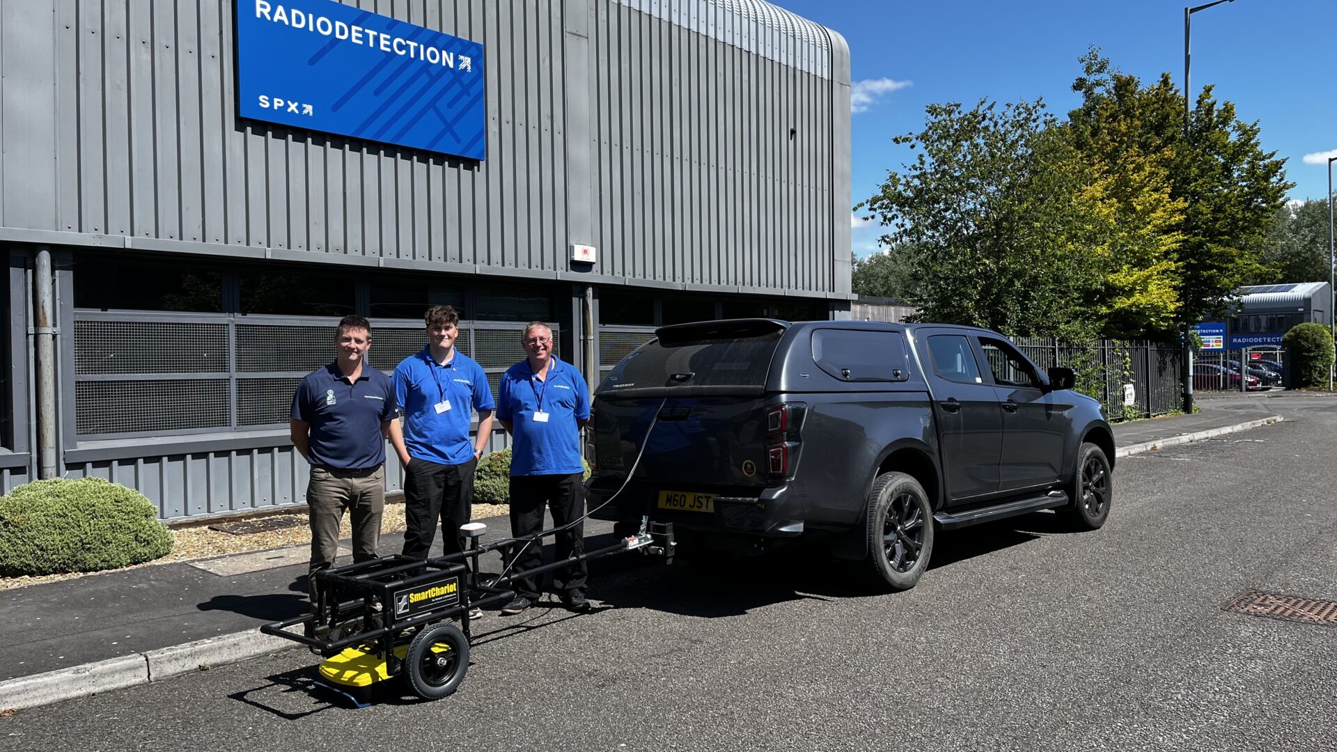
GeoDefinition, a leading provider of non-intrusive geotechnical investigation services, proudly announces the acquisition of a Noggin 250 Ground Penetrating Radar (GPR). This significant investment, procured through Radiodetection, a global leader in underground utility location solutions and GPR technology, marks a new era for GeoDefinition’s ability to conduct large-scale geotechnical surveys.
Responding to the escalating demand for comprehensive investigations on extensive brownfield sites, GeoDefinition sought a solution that could efficiently cover vast areas while providing optimal depth penetration. The Noggin 250 GPR, known for its effective 250 MHz centre frequency, strikes an ideal balance between depth and resolution, making it perfectly suited for such challenging environments.

“The arrival of the Noggin 250 GPR is a game-changer for GeoDefinition,” says Neill Wood, Director of GeoDefinition. “While we maintain our strong partnership with Seeka, part of Kemp Engineering, for high-resolution utilities mapping and shallow surveys, the Noggin 250 empowers us to delve deeper and cover significantly larger areas than more common GPR units. This is crucial for complex geotechnical projects where understanding subsurface conditions at greater depths and potentially over large areas is paramount.“
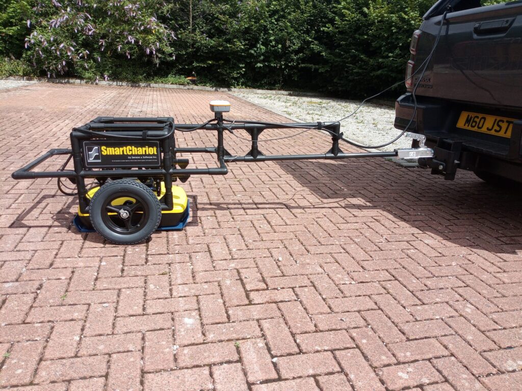
The Noggin 250, configured for vehicle-towed operation using either a wheeled “chariot” or a sled, offers GeoDefinition an additional highly efficient tool for geophysical investigations at scale. Its robust design allows for effective operation over hard surfaces and around metallic obstructions, factors that can often impede or compromise other geophysical methods.
Radiodetection, a world-leader in GPR solutions, provided not only the cutting-edge Noggin 250 unit but also expert advice and support, ensuring GeoDefinition’s seamless integration of the new technology. Radiodetection is committed to supplying innovative and reliable equipment that empowers professionals such as GeoDefinition to operate safely and efficiently in various subsurface applications.
Expanding Capabilities for Clients
This new acquisition significantly expands GeoDefinition’s service offerings. It enables the
company to:
- Undertake a wider range of large-scale geotechnical investigations, particularly on challenging brownfield sites and roadways.
- Provide even more cost-effective solutions by enabling rapid data acquisition over extensive areas.
- Conduct secondary investigations such as over potential shallow karstic features identified by other methods, especially in areas with relatively thin soil cover.
As with all of GeoDefinition’s investigations, the Noggin 250 provides a non-intrusive method, ensuring minimal to no environmental impact during surveys. This commitment to sustainable practices remains a cornerstone of our operations.
The acquisition of the Noggin adds to GeoDefinition’s already impressive array of geophysical investigation techniques, especially when it comes to large brownfield ites. We don’t expect our clients to understand what geophysical techniques may or may not do to help their projects which is why GeoDefinition is happy to take on the task of identifying the most cost effective solutions as part of overall project design. A conversation about geophysical options at an early stage can add value without adding cost.